
Coyote Two Moon 100k
Coyote Two Moon 100k
01 May 26 @1700
100K of Type 2 Fun (Okay, Maybe Type 3...)
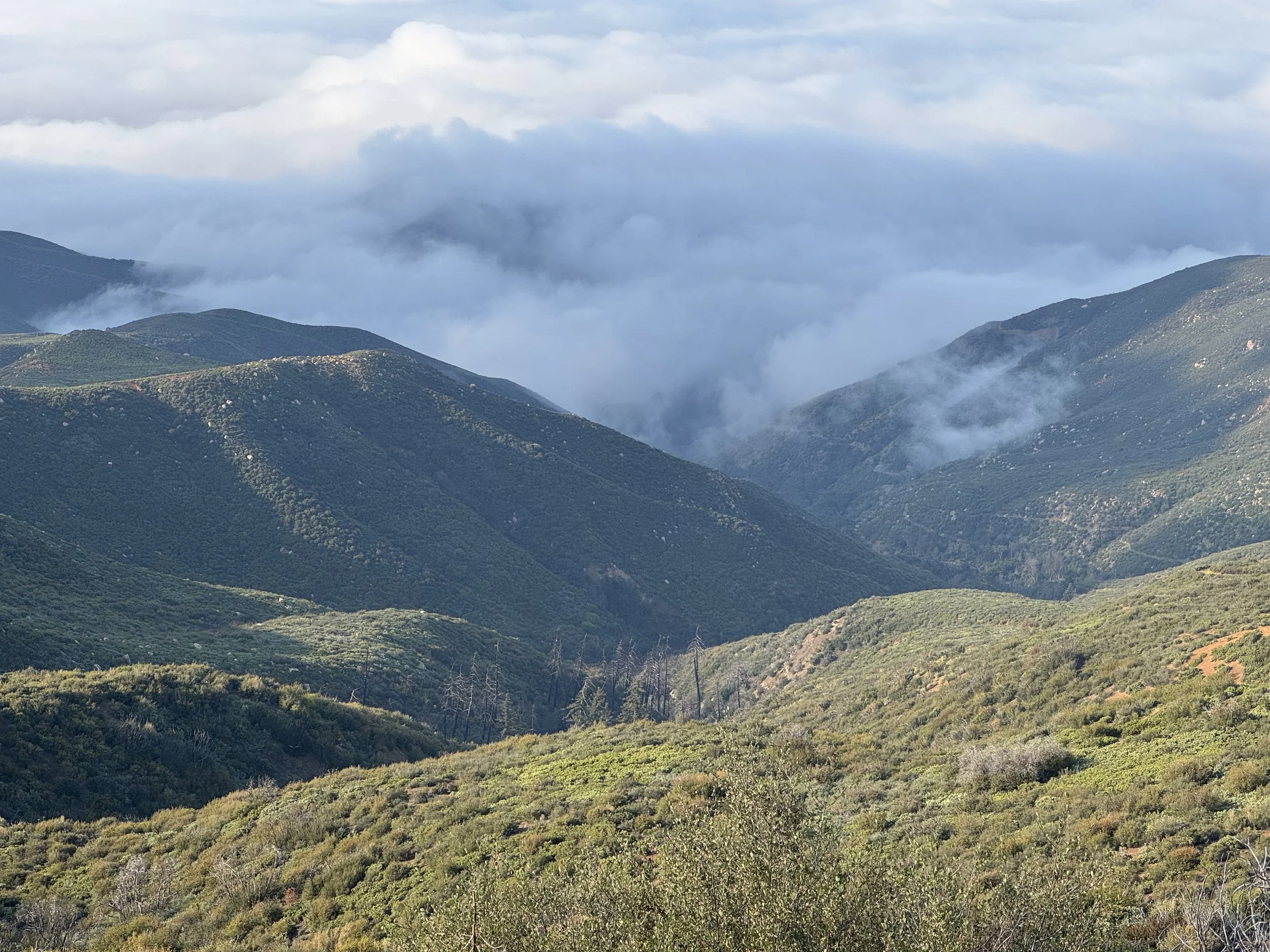
Looking for a 100K that’ll test your limits, destroy your quads, and possibly change your personality? You’re in the right place! Our 100K event is absolutely stacked with over 16,000 (16,431 to be exact) feet of glorious vert and not one, but TWO summit-worthy climbs to Ojai’s iconic Topa Topa Bluffs and Chief Peak. These two landmarks are kind of a big deal around here, People cry when they see them (usually from the uphill).
Challenge? Yes. Regret? Hopefully not.
This route is no joke. You’ll be climbing, descending, sweating, contemplating your life choices, then climbing some more. But if you time it right (and the universe cooperates), you might catch a golden sunset on the bluffs and a soul-stirring sunrise from the highest peak in the front country.
Imagine standing up there, wind in your face, sleep-deprived and emotionally unstable, whispering, “I paid to do this…”
It’s magical.
Generous Cutoff Time (42 hrs. to be exact) – Because You Deserve It
Worried about pace? Don’t be. This 100K shares the same generous cutoff as the 100-mile race, which means you’ve got plenty of time to take it all in the views, the aid stations, the existential crises. Go fast, go slow, or go full hobbit and stop for second breakfast on the trail. Just keep moving.
THE ADVENTURE BEGINS:
🕔 1700 (5:00 PM) | Friday, May 1st, 2026
Yes, we're kicking things off in the evening because we like our ultra-runners a little sleep deprived right from the start. It builds character. Also, night running is just cool.
So lace up, hydrate aggressively, and bring your best headlamp. This is the kind of event you'll never forget partially because your legs will remind you for weeks.


Start Rock Tree Sky School Start at an Elevation of 1,574 ft. - Topa-Topa AS # One at 5,273 ft.
Mile 0.0 to Mile 7.09: The “Let’s-Get-This-Party-Started” Zone
You’re starting at Rock Tree Sky School, chilling at 1,574 ft basically sea level for mountain goats. Your goal? The Topa-Topa Aid Station #1, a lofty 5,273 ft (yes, you’ll feel the burn).From the school, trot north on Sisar Rd, waving hi to the houses on both sides. At half a mile, you’ll hit an iron gate no, not to a secret castle, just where the road turns dirt. Roll on through some stream crossings and some twisty switchbacks. Around mile 4.24, you’ll meet another giant brown gate Right after that, sneak onto the sneaky Red Reef single-track trail on your right. By mile 5.29, you’ll hit White Ledge campground (hello, rest spot!). Keep climbing until you hit a fork in the road at mile 6.94 (elevation 5,111 ft). Turn right towards those epic Topa-Topa bluffs and BAM, Aid Station #1 at mile 7.09. Treat yourself to a snack — you earned it!
Topa-Topa AS # One at an Elevation of 5,273 - Topa-Topa AS # One at an Elevation of 5,273
Mile 7.09 to Mile 10.76: Climb Like a Goat
Fuel up, because now you’re headed for more steep climbing. From Aid Station #1, head east on the fire road, but don’t get too comfy. At mile 7.47, ditch the fire road for the switchbacks TopaTopa Bluff trail the scenic (and harder) route.You’ll reach the summit at mile 8.2 (elevation 6,379 ft) time for your first bracelet! Because nothing says “I’m hardcore” like trail jewelry. Follow the ribbons and Then, zip down the single track towards Old TopaTopa Bluff Road, turn left, and keep cruising till you reconnect with Red Reef trail. At mile 10.60, guess what? Aid Station #1 AGAIN. You’re a trail pro now.
Topa-Topa AS# One at an Elevation of 5,273 ft. - Rose Valley campground AS # Two and 3,416 ft.
Mile 10.76 to Mile 17.56: Lion King’s Territory
Head west on FS05NO8 until you hit Lion Canyon trail (where lions might live but probably don’t, or the do). Take a right at mile 11.41 and plunge into the narrow, twisty Lion Canyon single-track. No intersections here, so you won’t get lost... hopefully. At mile 15.1, you’ll reach West Fork and East Fork Lion campground (think of it as Lion HQ). Warning: pay attention here or you are coming back up this way and can easily make a wrong turn . Cross the stream, follow the trails, and shortly after, turn left on Rose-Lion Trail. Then it’s a small climb and a canyon dance to Aid Station #2 at Rose Valley campground (mile 17.56). Refuel like a champ!
Rose Valley AS # Two at an Elevation of 3,416ft mi -TopaTopa Aid station # One at 5,271ft
Mile 17.56 to Mile 23.65: Backtracking Blues
Retrace your steps back up to the ridge on FS05NO8. At mile 19.67, keep straight on Lion Canyon trail for the climb back up. When you hit the road at mile 23.29, turn left towards Aid Station #1 your trusty checkpoint at mile 23.77. Two climbs down! Time to celebrate? Eh, maybe after a nap.
TopaTopa Aid station # One at an Elevation of 5,271ft - Thacher Creek Trailhead AS # Three at 1,370ft
Mile 23.65 to Mile 34.90: Downhill-ish, but Not Really
From Aid Station #1, head west and jump back onto Red Reef Trail at mile 23.80. Down, down, down to White Ledge campground (mile 25.50), cross some streams, then turn right on Sisar Canyon fire road (mile 26.5) for a slow uphill. At mile 30.25, take a left on Horn Canyon Trail and cruise down to “The Pines” campground (mile 31.9). Keep descending to Thacher Creek Trailhead Aid Station #3 (mile 34.90). Hydrate, because you’re still not done.
Thacher Creek Trailhead AS # Three at an Elevation of 1,370 ft. - Rose Valley campground AS # Two at 3,416ft.
Mile 34.90 to Mile 46.86: Chief Peak Showdown
Re-tracing your steps and Backtrack a bit to Sisar Canyon fire road at mi 39.45 and head toward Chief Peak. At mile 42.0, you’ll find a water-only unmanned aid station at an Elevation of 4,837ft so bring your own snacks, no freebies here.
Summit Chief Peak at mile 42.5 (bracelet #2 for the win!). Take in the view, then follow ribbons north back to FS-05NOB and down to Rose Valley campground (mile 46.86). This is where your legs might start complaining loudly.
Rose Valley camp ground AS # Two at an Elevation of 3,416ft - TopaTopa Aid station # One at 5,271ft
Mile 46.86 to Mile 52.24: Climb All the Things
Back on FS 05N42.2, prepare for a steep 2.44-mile climb with a 1,597 ft vertical gain. It’s like stairs, but outdoors, with more dirt and less Netflix. As you make your way to the 3-way intersection of FS, 05N42.2 and FS-05NOB8 stay left (East) along the FS-05NOB8 Fire Road.Hit that water-only station again at mile 52.39 It is the same spot you passed when making you way up to Chief Peak earlier (yay, déjà vu) and Shortly after the unmanned aid station you will go left at mile 54.09 onto FS 05N08 towards Sisar Peak. Keep pushing until you’re back at Aid Station #1 at 5,271 ft. If your legs aren’t jelly yet, congrats!
TopaTopa Aid station # One at an Elevation of 5,271ft Rock Tree Sky School finish 1,574 Ft
Mile 52.24 to Mile 63.89: The Grand Finale
Fill up, stretch, and get ready for the long downhill cruise. Head west on FS-05N08, then left on Trail 21W08 towards White Ledge campground at mile 58.54 (okay, maybe you’re dreaming of finishing already).
Pass the campground, go through the big brown gate, and keep rolling downhill on Sisar Canyon Fire Road. Stay on it till you reach the finish line back at Rock Tree Sky School, mile 63.89.
Congrats! You survived the Coyote Two Moon 100k ultra adventure your legs hate you, but your hearts proud. Time to brag about those bracelets and maybe never run again... until next year.
